
Using Avi-Go NOTAM Radar to Check Aviation Hazards


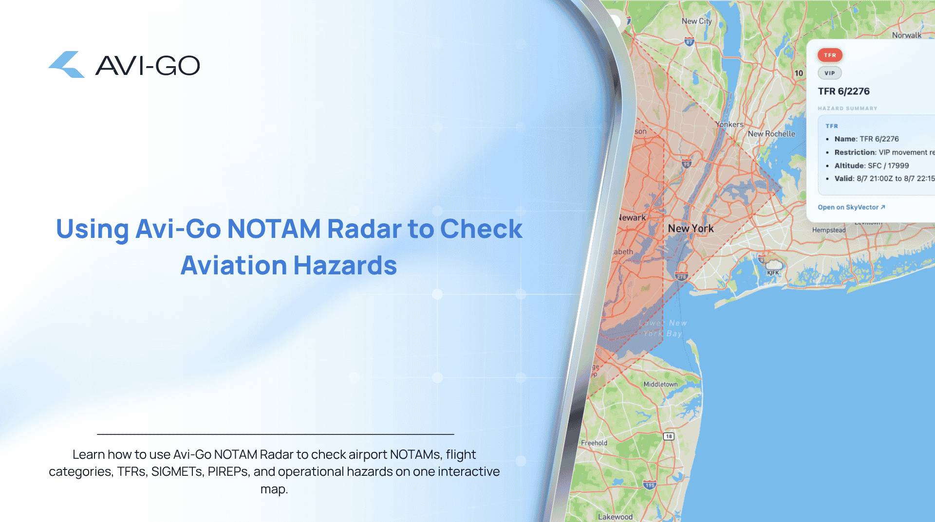
A runway closure, temporary airspace restriction or navigation-system outage can quickly affect an otherwise straightforward flight.
The challenge is not simply finding a Notice to Air Missions, commonly known as a NOTAM. Aviation professionals must also identify which notices are relevant, understand the surrounding operational conditions and determine whether the original flight plan remains practical.
Avi-Go NOTAM Radar brings airport NOTAMs, flight categories and operational hazards together on an interactive aviation map. It gives charter operators, brokers, dispatchers, pilots and other aviation professionals a faster way to identify potential disruptions before they affect a trip.
What Is Avi-Go NOTAM Radar?

Avi-Go NOTAM Radar is an interactive flight-planning tool designed to help users scan airport NOTAMs and nearby operational hazards from a map-based interface.
Instead of reviewing airport information entirely through separate text-based sources, users can explore the relevant geographic area and examine the conditions surrounding an airport or route.
The tool includes:
- Airport NOTAM information
- Visual flight categories
- Temporary Flight Restrictions
- Standard and convective SIGMETs
- Pilot reports
- Weather and hazard map views
- An AI-powered airport question field
Avi-Go describes the tool as a way to scan airport NOTAMs, flight categories and operational hazards on an interactive aviation map.
Why NOTAM Monitoring Matters
NOTAMs communicate time-sensitive information that may affect a flight, airport or section of airspace.
Depending on the location and operation, a NOTAM may concern:
- Runway or taxiway closures
- Lighting or navigation-aid outages
- Airport operating-hour changes
- Construction activity
- Airspace restrictions
- Procedures that are temporarily unavailable
- Obstacles or other operational limitations
A single notice can influence airport selection, departure time, routing, fuel planning or the feasibility of a charter request.
However, a NOTAM should rarely be evaluated in isolation. Weather conditions, temporary restrictions and reported turbulence or icing may also affect the decision. Avi-Go NOTAM Radar helps place several of these signals in one visual environment.
How to Use Avi-Go NOTAM Radar
1. Open the Interactive NOTAM Map
Visit the Avi-Go NOTAM Radar page to open the global aviation map.
The broad map view helps you understand the geographic context around a proposed departure airport, destination or alternate. Zooming into an airport area reveals more detailed operational information.
The interface directs users to zoom in to airports to access NOTAM details.
2. Locate the Airport You Want to Review
Navigate to the relevant airport or region.
You can use the tool to examine:
- The planned departure airport
- The destination airport
- Potential alternates
- Nearby airports that could support a revised plan
- Airports along a frequently operated route
For charter planning, it is useful to review both the requested airport and realistic alternatives. A nearby airport may provide a better option when the original destination has significant restrictions.
3. Review the Airport’s NOTAMs
Select the airport to inspect its available NOTAM information.
Focus first on notices that could directly change the operation, including:
- Closed or shortened runways
- Taxiway restrictions
- Unavailable instrument procedures
- Navigation or lighting outages
- Parking or apron limitations
- Temporary changes to operating hours
Consider the validity period of each notice. A restriction that is active today may no longer apply on the proposed flight date, while a future notice may begin before the scheduled arrival.
4. Check the Flight Category
Avi-Go NOTAM Radar displays four flight categories:
- VFR
- MVFR
- IFR
- LIFR
These categories provide a quick visual indication of current aviation weather conditions around an airport.
A lower flight category does not automatically mean a flight cannot operate. However, it can signal that further weather review, instrument capability or additional operational planning may be required.
The category layer is particularly useful when comparing several nearby airports. One airport may face poor conditions while a practical alternative has more favourable visibility or ceiling conditions.
5. Turn On the Hazard Layers
The map includes hazard filters for:
- TFRs
- SIGMETs
- PIREPs
Avi-Go notes that its SIGMET layer includes both standard and convective SIGMETs.
These layers help users understand whether a flight may be affected by conditions beyond the airport itself.
Temporary Flight Restrictions
A Temporary Flight Restriction can limit or prohibit operations within a defined section of airspace.
Check whether a TFR affects:
- The departure or arrival airport
- The expected flight path
- A planned alternate
- A possible repositioning route
SIGMETs
SIGMETs highlight significant weather conditions that may affect aircraft operations.
These can include severe turbulence, severe icing, thunderstorms and other hazardous conditions. Convective SIGMETs are especially relevant when widespread or intense thunderstorm activity could influence routing.
PIREPs
Pilot reports provide observations submitted from aircraft in operation.
They may contain useful information about actual turbulence, icing, cloud layers or other conditions being experienced in the area. PIREPs can add real-world context to forecasts and formal weather advisories.
6. Compare the Weather and Hazard Views
Avi-Go NOTAM Radar allows users to switch between weather and hazard views.
Use the weather view to understand flight conditions around the airport. Then switch to the hazard view to check restrictions, significant weather advisories and pilot reports.
Reviewing both views can reveal combinations that might be missed when examining one source at a time. For example, a destination may have an active runway restriction while the most practical alternative is affected by convective weather.
7. Ask the AI About the Airport
The interface includes an “Ask about this airport” field.
This can be used to request a clearer explanation of the airport situation or to focus on a particular operational question.
Useful questions may include:
- What are the most important active NOTAMs at this airport?
- Are any runways currently closed?
- Which hazards may affect arrival?
- Are there restrictions relevant to business aviation?
- What should I check before planning a flight to this airport?
AI-generated guidance should support operational review rather than replace official flight-planning sources or professional judgement.
8. Recheck Conditions Before the Flight
NOTAMs, weather categories and aviation hazards can change.
A review completed when a charter request is first received may not reflect the conditions on the day of operation. Check the airport again during the planning process and before departure.
A practical workflow is to review the map:
- When evaluating the original request
- Before confirming the preferred airport
- During final trip preparation
- Shortly before departure
Users can conduct limited searches before being asked to log in, while continued map searching requires an Avi-Go account.
How Charter Operators Can Use NOTAM Radar
Charter operators can use the tool during initial feasibility checks.
Before accepting or confirming a trip, the operations team can examine the departure airport, destination, alternates and surrounding hazards. This can expose potential restrictions early enough to revise the schedule or advise the client.
For example, an operator may discover that:
- The destination runway will close before the planned arrival
- A nearby airport has better operating conditions
- A TFR affects the expected route
- Severe weather may require additional routing or fuel
- Parking or airport-access restrictions could affect the mission
Identifying these issues early can reduce last-minute operational changes.
How Charter Brokers Can Use NOTAM Radar
Brokers may not make final operational decisions, but access to airport disruption information can improve communication with clients and operators.
Before presenting a charter option, a broker can review the relevant airport area and identify obvious concerns. This helps the broker ask better questions and avoid proposing an itinerary that may be difficult to operate.
The tool can also help explain why an operator recommends:
- A different departure time
- A nearby alternative airport
- A technical stop
- A revised route
- Additional contingency planning
This creates a more transparent booking process and helps manage passenger expectations.
How Dispatchers and Operations Teams Can Use It
Dispatchers can use Avi-Go NOTAM Radar as an early-stage situational-awareness tool.
The interactive map helps teams move from a broad regional view to specific airport conditions. It can be especially useful when managing multiple trips, monitoring changing conditions or comparing alternatives.
A dispatcher might use the radar to:
- Screen airports before detailed planning
- Identify notices that require closer investigation
- Compare destination and alternate conditions
- Monitor hazards across a route
- Brief colleagues on emerging operational risks
The visual format can make it easier to communicate the overall situation than reviewing several disconnected text feeds.
Example NOTAM Radar Workflow
Imagine a client requests a private flight from London to an airport in southern France.
The charter team could use the following process:
- Open the NOTAM Radar and locate the requested destination.
- Review active airport NOTAMs for runway, taxiway or operating-hour restrictions.
- Check whether the destination is currently classified as VFR, MVFR, IFR or LIFR.
- Activate the TFR, SIGMET and PIREP layers.
- Examine nearby airports that could serve as alternates.
- Ask the airport AI field to summarise the most important issues.
- Share any relevant concerns with the operator.
- Recheck the map closer to departure.
The radar does not replace formal dispatch and operational procedures. It helps the team identify where further attention may be needed.
Benefits of Using an Interactive NOTAM Map
Faster Initial Screening
A map helps users identify airports and hazards geographically rather than reviewing every information source independently.
Better Situational Awareness
Combining NOTAMs, weather categories and hazard layers provides a broader view of the operating environment.
Easier Airport Comparison
Users can evaluate the requested airport alongside nearby alternatives.
Clearer Team Communication
A shared visual reference can help brokers, operators and dispatchers discuss the same operational concerns.
Earlier Disruption Detection
Potential issues can be identified before a flight is confirmed, reducing the chance of avoidable last-minute changes.
Important Limitations
Avi-Go NOTAM Radar should be treated as a planning and situational-awareness resource.
NOTAMs can be complex, abbreviated and operationally specific. Their significance may depend on aircraft performance, crew qualifications, local procedures, weather and regulatory requirements.
Before operating a flight, users should verify all relevant information through approved and authoritative aviation sources. Final decisions should remain with qualified flight-operations personnel and the flight crew.
Make Airport Disruptions Easier to Identify
Aviation conditions can change quickly, and even one overlooked notice may affect an entire charter plan.
Avi-Go NOTAM Radar helps aviation professionals examine airport NOTAMs, weather categories and hazards within one interactive global map. By checking the departure airport, destination, route and alternatives, users can identify operational concerns earlier and plan with greater clarity.
Explore the Avi-Go NOTAM Radar and review the conditions surrounding your next flight.

Avi-Go AI as an Intelligent Operating System for Business Aviation


Avi Tools: Explore 9 Free Business Aviation Tools from Avi-Go

What Is Business Aviation and How Is It Different From Aviation?
Ready to Supercharge
Your Business Aviation Tech Stack with AI and Data?
Sign up free and start using the tools available in your chosen plan.
Discover how our aviation technology helps you work more efficiently and grow with confidence.
Subscribe to the Avi-Go Newsletter
Business aviation data, insights, and trends — trusted by 10,000+ professionals worldwide.