FAA Issues Special Flight Procedures for 2026 Burning Man at Black Rock Desert, Nevada
Why It MattersTemporary event airspace with limited radar coverage shifts responsibility onto pilots to self-coordinate separation, radio contact and altitude compliance rather than relying on standard air traffic control services.
What happened
Special flight procedures have been published for the 2026 Burning Man event, set to run August 26 through September 8 in the vicinity of Black Rock Desert, Nevada. During the event, Black Rock City LLC will create and operate a private-use airport, Black Rock City Municipal Airport (88NV), on land owned by the Bureau of Land Management.
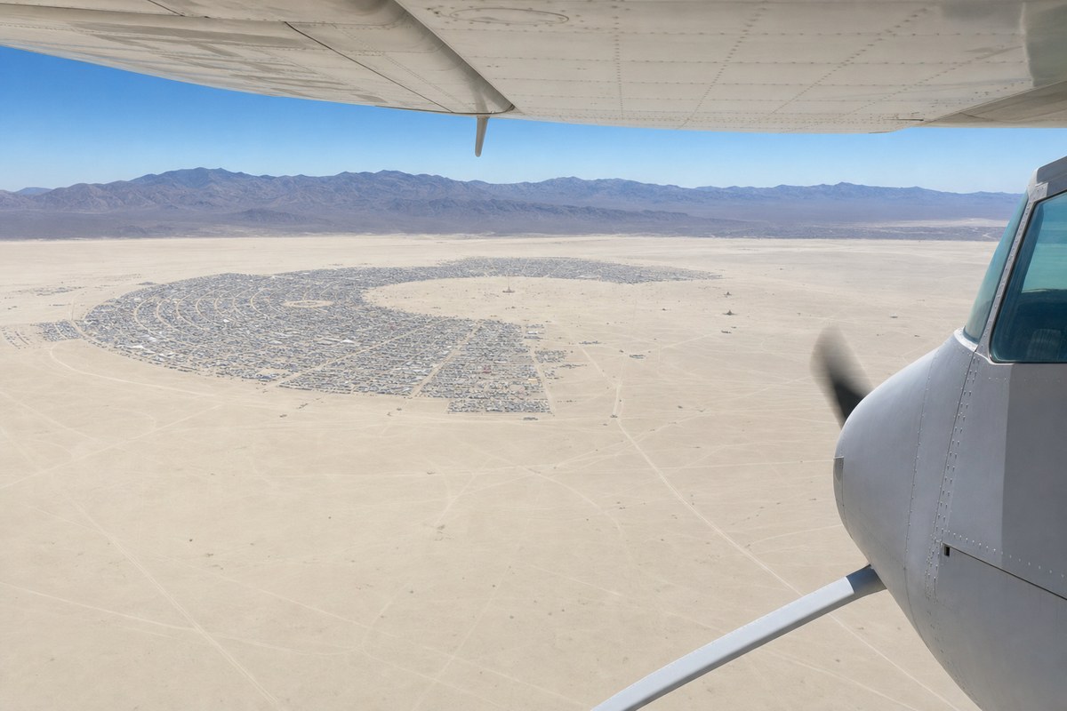
Sightseeing aircraft performing scenic orbits over Black Rock City are directed to maintain 7,000 feet MSL beginning at Empire Airport (18NV), establish radio contact with 88NV on 134.7 MHz within ten miles, remain outside the pentagon-shaped city perimeter fence, and circle clockwise. Right traffic is in effect for runways 5L and 5R. Two helipads have been established: Helipad H1, measuring 200 feet by 200 feet and marked with cones, at 40° 45.7206' N / 119° 12.4446' W, and Medevac Helipad H2, also 200 feet by 200 feet and marked with cones, at 40° 45.5583' N / 119° 13.1058' W. The runway surface is dry alkaline lakebed conditioned by rolling and watering. Traffic Pattern Altitude is 5,000 feet MSL for aircraft below 100 KIAS on downwind and 5,500 feet MSL for aircraft at or above 100 KIAS.
Oakland Air Route Traffic Control Center has advised that radio and radar coverage below 10,000 feet is limited near Empire Airport and Black Rock City Municipal Airport, with radar service expected to terminate around Empire Airport. As of 2024, 88NV is in Oakland Center's database and may be used as a flight-following destination. Departing aircraft requesting VFR flight following westbound or southbound should contact Oakland Center on 128.8 MHz, while those heading north or eastbound should contact Salt Lake Center on 132.25 MHz. Pilots planning IFR departures with Oakland Center should expect a minimum IFR altitude of 13,000 feet westbound over the Sierra Nevada range and 11,000 feet northbound or eastbound, with lower altitudes possibly available on airways. Pilots are advised to avoid unnecessary flights near KTRK, KRNO, and KTVL due to increased glider operations and elevated traffic loads, and to remain alert to active Temporary Flight Restrictions for firefighting operations along their flight paths.
Industry impact & what to watch
Large temporary gatherings that draw substantial general-aviation traffic into remote airspace routinely require this kind of bespoke procedure set, layering a private-use airport, dedicated frequencies and altitude segregation onto airspace that otherwise has little structure. The pattern recurs each year around Black Rock Desert because the terrain, the lakebed runway and the seasonal surge in sightseeing and shuttle flights create conditions that standard controlled-airspace procedures do not address.
The limited radar and radio coverage below 10,000 feet near Empire Airport and 88NV means separation during arrival, departure and orbiting depends heavily on pilots monitoring the published frequencies and following the clockwise orbit and altitude rules rather than on continuous radar service. Concurrent glider activity near KTRK, KRNO and KTVL, plus the possibility of firefighting TFRs along the same routes, adds further variables pilots must track independently of the event procedures themselves.
Whoever operates flights into this window will need to reconcile the published minimum IFR altitudes over the Sierra Nevada, the flight-following handoff points between Oakland and Salt Lake Centers, and any TFRs that appear closer to the event dates, since those restrictions are announced separately and can change routing on short notice.